


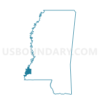
Morgantown Voting District, Adams County, Mississippi
About
Outline

Summary
| Unique Area Identifier | 605035 |
| Name | Morgantown Voting District |
| County | Adams County |
| State | Mississippi |
| Area (square miles) | 1.03 |
| Land Area (square miles) | 1.03 |
| Water Area (square miles) | 0.00 |
| % of Land Area | 100.00 |
| % of Water Area | 0.00 |
| Latitude of the Internal Point | 31.58222940 |
| Longtitude of the Internal Point | -91.34843740 |
Maps


Graphs
Select a template below for downloading or customizing gragh for Morgantown Voting District, Adams County, Mississippi


Neighbors
Neighoring Voting District (by Name) Neighboring Voting District on the Map
- Foster Mound Voting District, Adams County, MS
- Northside School Voting District, Adams County, MS
- Oakland Voting District, Adams County, MS